Trollfjell Geopark along the coast in Mid-Norway, covers an area of 10,082 km2. Approx. 70 % is sea and 30 % land. The area as a whole has more than 12,000 islands.
View moreVega islands were UNESCO listed in 2004 and is a tribute to generations of farmers and fisherman's way of living through the last 1500 years.
View moreNidarosdomen (Nidaros Cathedral) is the world’s northernmost medieval cathedral and Norway’s national sanctuary.
View moreThe Norway Building, or Thamspaviljongen, is a unique building – built as a stave church – with an equally unique history.
View moreAursjøvegen is loved by adventure motorcyclists for the feeling of wilderness. The road is steep, narrow, partly gravel and without fences.
View more
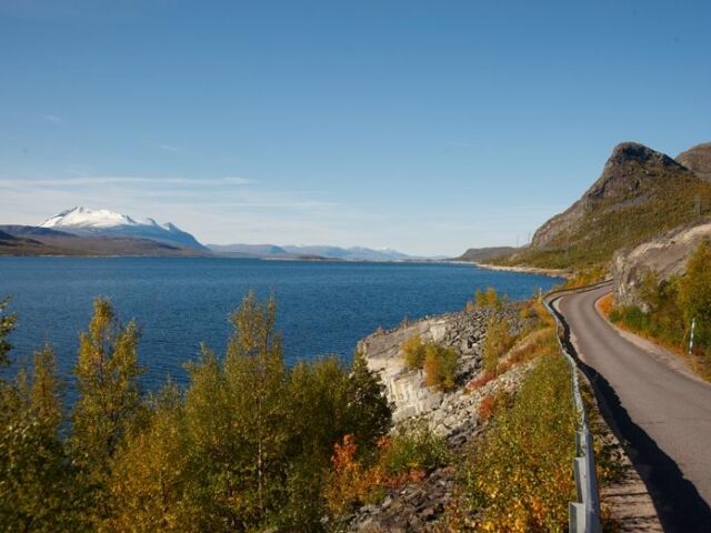
The 630 km long County Road 17 (Norwegian: Fylkesvei 17) is also known as the Coastal Highway (Norwegian: Kystriksveien)
View more
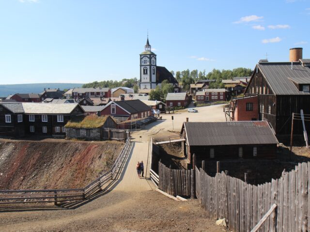
Røros is one of two Norwegian town designed for mining. The old, unique wooden buildings from the 17th century is now UNESCO listed.
View more
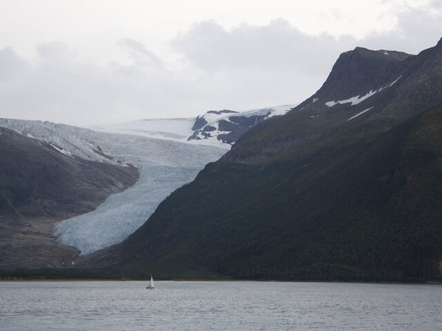
Norway's second-largest glacier. It covers an area of about 370 square kilometers and is the easiest accessible glacier in Europe.
View moreThe Trans Euro Trail — or just TET for short — is all adventure riders and dirt road travelers dream. This is section 2b.
View more