Photo: Daniele Faieta, flickr.com
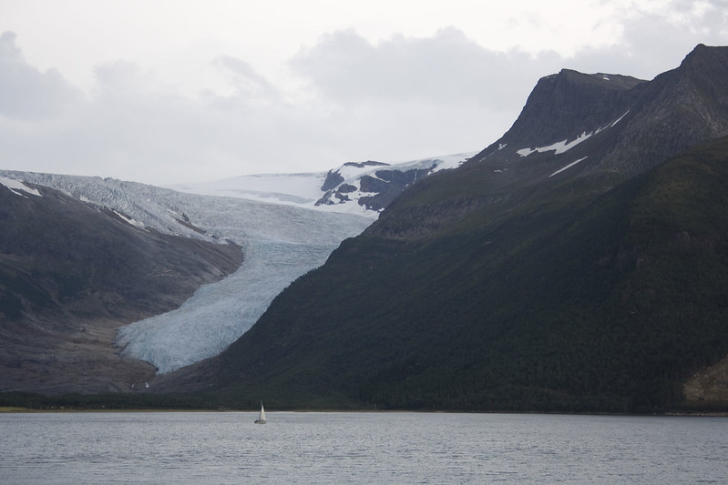
Svartisen (The black ice) is Norway’s second-largest glacier, and covers an area of about 370 square kilometers. In the ‘small ice age’ in the middle of the 18th century, Svartisen was one continuous glacier. Today it is divided into two: the eastern and western ice.
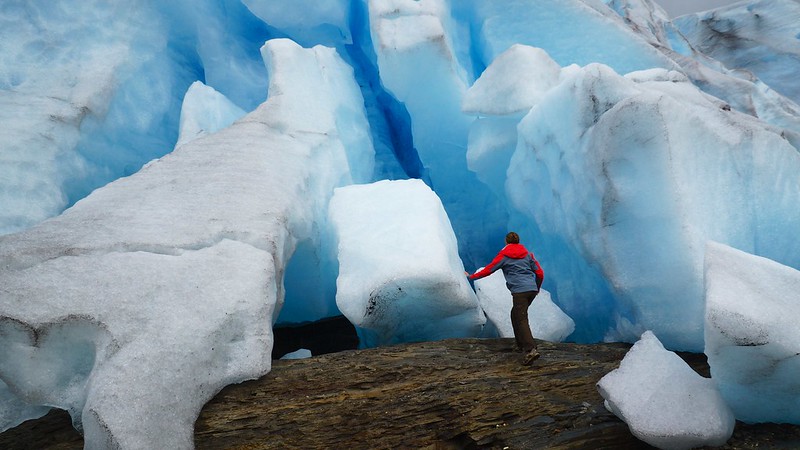
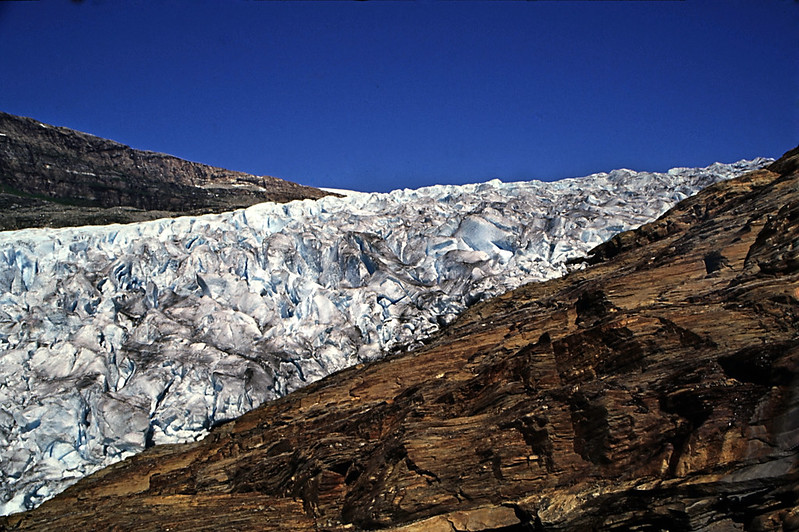
The glacier extends through the municipalities of Rana, Meløy and Rødøy, all in Nordland county. The Svartisen was mapped in 1964, and is mainland Europe’s lowest glacier, only 20 masl. This makes the glacier easily accessible as a tourist destination. The highest point on the glacier in the west is Snøtinden, which is 1594 masl. In the east is the highest point Istinden with its 1572 masl. The name Svartisen comes from the old term «Svartis» (black ice). It describes the characteristic deep blue color of the ice, in contrast to the white snow. The ice masses show a range of blue tones, from transparent ice, to turquoise and dark blue.
The Arctic Circle runs over the southern part of the glacier.
The easiest accessible glacier
Large parts of Svartisen are located at an altitude of 12-1400 meters. On the ice plateau, mild, moist air masses fall from the Atlantic Ocean like snow most of the year, and the ice masses grow. Then the ice gradually descends the valleys and forms glacial tongues. The Engen glacier is the tongue that reaches the farthest down to the sea of both the glaciers on the Svartisen and on the whole of mainland Europe. It is therefore the most accessible glacier to visit in Europe. Engenbreen is located in the heart of the Holandsfjord in Meløy municipality.
How to reach it
If you are on a tight schedule and just passing by, you can get a glimpse of the glacier from Holansvika resting area along Road 17. If you have more time to spare, Engenbreen shuttle boat runs a fixed route across the fjord from Holandsvika just off the main road. The trip takes 10 min and runs from the end of May to the beginning of September. Here you get a chance to see the glacier up close.
It is also possible to do glacier hiking or glacier climbing, or if you are staying, visit the tame moose at the camp ‘Svartisen Moose’. More info at “Visit Bodø”.
Other locations in this part of Norway:
'The Golden Road' passes through beautiful Inderøy municipality in North-Trøndelag, with food, art and cultural experiences along the way.
View more
Trollfjell Geopark along the coast in Mid-Norway, covers an area of 10,082 km2. Approx. 70 % is sea and 30 % land. The area as a whole has more than 12,000 islands.
View more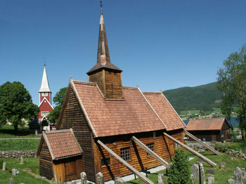
Rødven stave church is beautifully located by the Romsdalsfjord among the peaks of the Romsdalsalpane mountains.
View more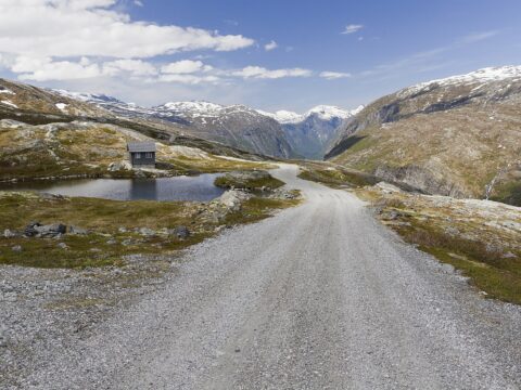
Aursjøvegen is loved by adventure motorcyclists for the feeling of wilderness. The road is steep, narrow, partly gravel and without fences.
View more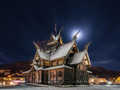
The Norway Building, or Thamspaviljongen, is a unique building – built as a stave church – with an equally unique history.
View more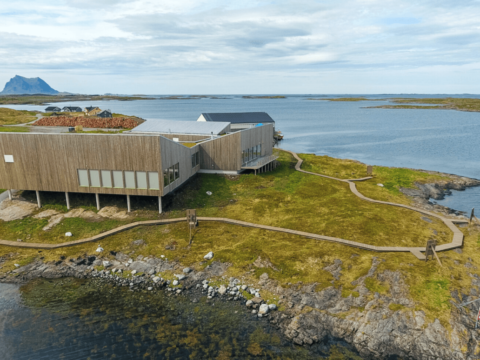
Vega islands were UNESCO listed in 2004 and is a tribute to generations of farmers and fisherman's way of living through the last 1500 years.
View more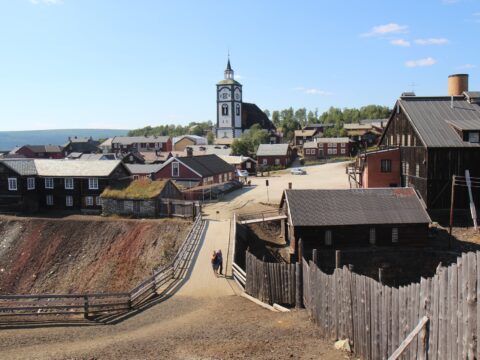
Røros is one of two Norwegian town designed for mining. The old, unique wooden buildings from the 17th century is now UNESCO listed.
View more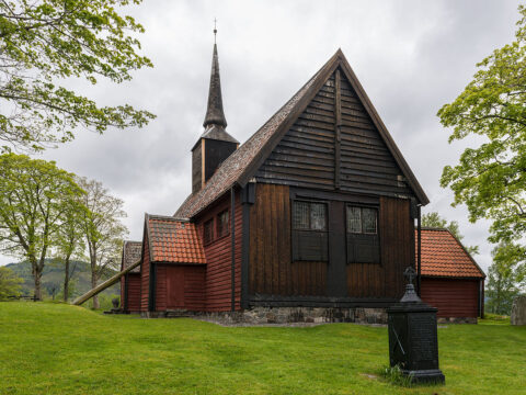
Kvernes Stave Church from the 14th century is located at Averøy in Møre og Romsdal. The old church is among the smallest ever built.
View more