
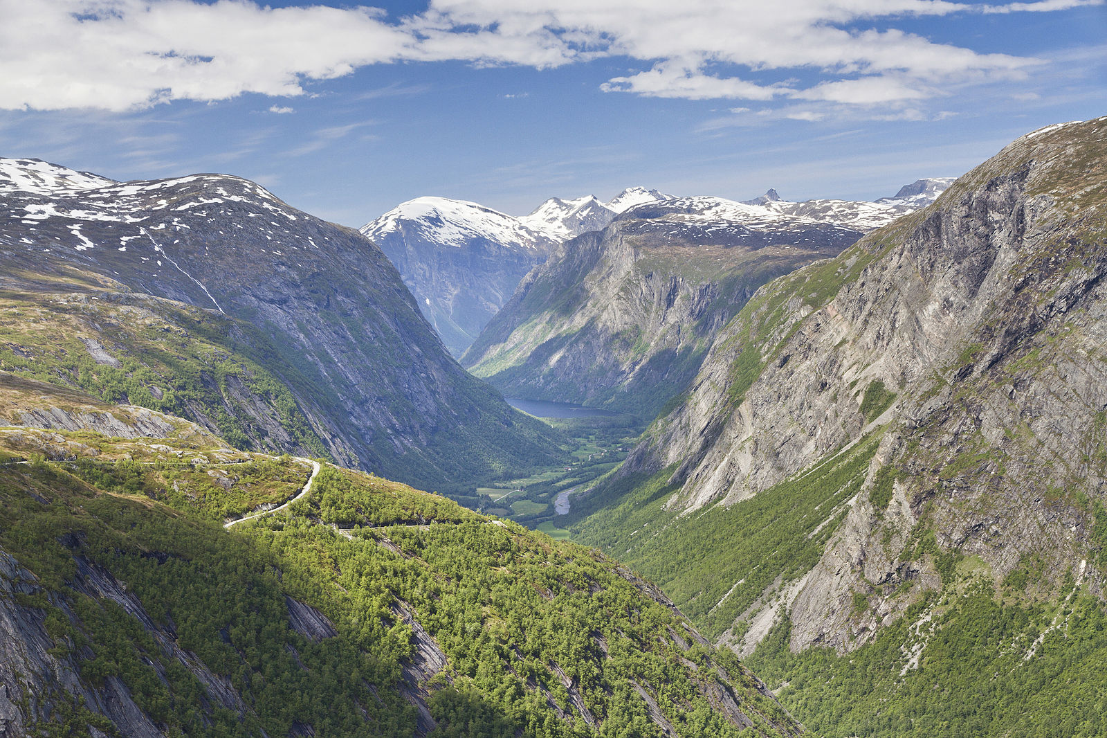
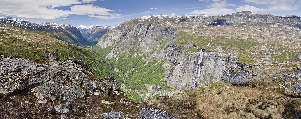
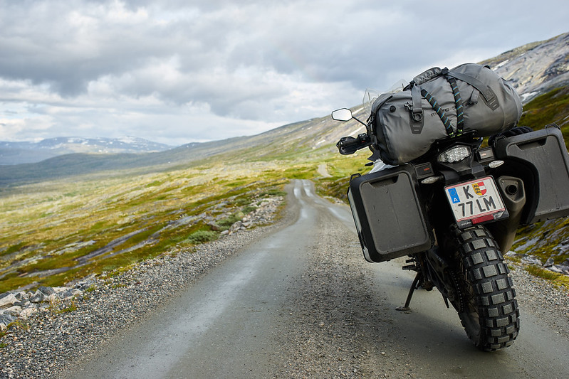
So, you thought Trollstigen (the Troll’s ladder) was breathtaking? Aursjøvegen is next level. Loved by adventure motorcyclists and 4×4 enthusiasts for the feeling of wilderness. Parts of the road is not for the faint-hearted; it is steep, narrow, partly gravel, partly without fences – and it’s a long, long way down to the bottom of the valley…:-)
But enough of the scary crap; this is truly an amazing road that you will remember forever. It is close to 100 km long, so you will spend 3-3.5 hours driving. But add an hour or two as you want to stop to take pictures, and maybe even enjoy some of the many sights along the way (described further down).
Tollroad
55 km of the road is a toll-road. 100,- NOK one-way. You can only pay by card – as the gate is automatic – so bring your plastic.
Aursjøvegen is surrounded by Dovrefjell-Sundalsfjella National Park – which is also a conservation area, so be care- and respectful. Bring your garbage back and don’t leave marks and scars!
What makes Aursjøvegen so remarkable, is that you drive from one fjord to the next, and in between climbing some really wild and beautiful mountains. The road is a construction road, built in 1947 for the Aura power station, so the road quality is not the best. (Like us adventure motorcyclist’s love, right?)
In fact, on their website, they have some security warnings;
- The road is not recommended for busses or trailers
- The road is sometimes narrow and without a fence
- Parts of the road are really steep, and you often don’t have a good overview
- Meeting traffic might surprise you
- In some areas there is a danger of landslide
- If heavy rain or danger of landslide, the road might be closed
- In general, drive carefully, be considerate and go slowly to admire the beautiful nature and the rich cultural history in the area.
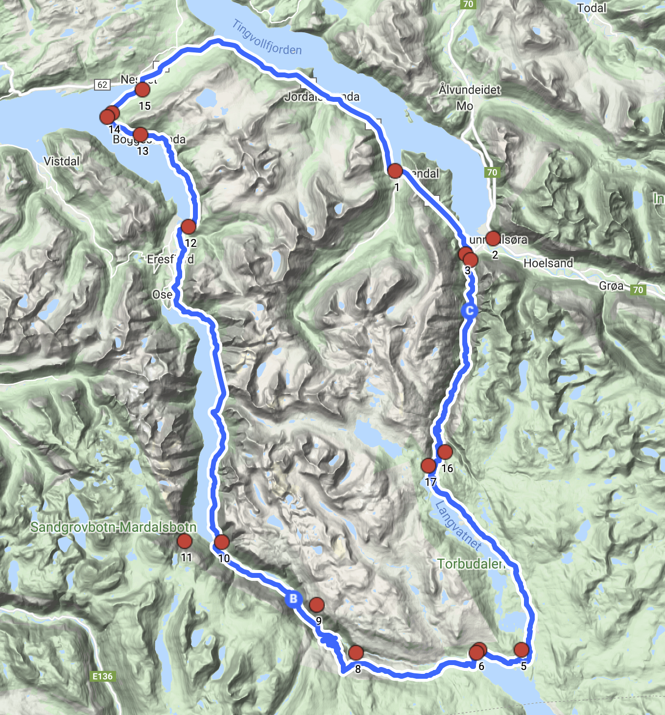
Do a round trip
If you have a look at the map to the right, you’ll see that you can easily turn this into a round trip. In one of the pictures below, you’ll see a map with some interesting locations to check out. This is the short explanation for each of them:
- The small town Øksendalsøra
- The town Sunndalsøra
- Power station
- Trædal hotel and tourist centre
- Torbudalen mountain camp
- Torbuvollen shielding
- Aursjø cabin
- The Aursjø dam
- Aursjø plunge
- Finnset cabins
- Mardalsfossen – waterfall
- The English house
- Rock carvings
- Nesset priest house
- Eidssvåg fjord hotel
- Jette pot
- Railway
- The Bjørnson track
If you ride here to do this route, you are not far from some other great locations in the area. Like the Atlantic Road (Norwegian Senic Route), Gudbrandsjuvet, Trollstigen, Geiranger fjord (UNESCO), Flydalsjuvet, Dalsnibba and the old Strynefjell mountain road (Norwegian Scenic Route).
Other locations in this part of Norway:
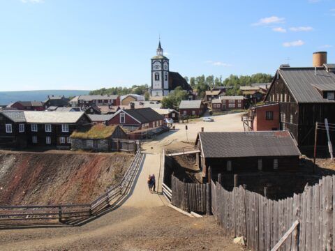
Røros is one of two Norwegian town designed for mining. The old, unique wooden buildings from the 17th century is now UNESCO listed.
View more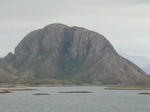
Trollfjell Geopark along the coast in Mid-Norway, covers an area of 10,082 km2. Approx. 70 % is sea and 30 % land. The area as a whole has more than 12,000 islands.
View more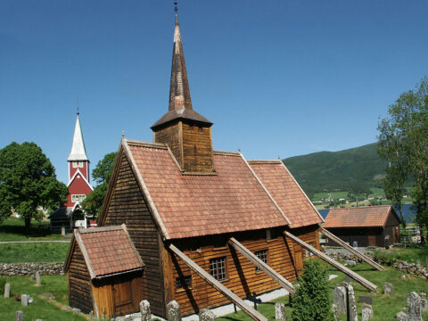
Rødven stave church is beautifully located by the Romsdalsfjord among the peaks of the Romsdalsalpane mountains.
View more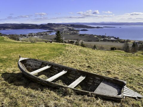
'The Golden Road' passes through beautiful Inderøy municipality in North-Trøndelag, with food, art and cultural experiences along the way.
View more
Nidarosdomen (Nidaros Cathedral) is the world’s northernmost medieval cathedral and Norway’s national sanctuary.
View more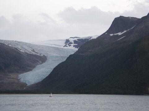
Norway's second-largest glacier. It covers an area of about 370 square kilometers and is the easiest accessible glacier in Europe.
View more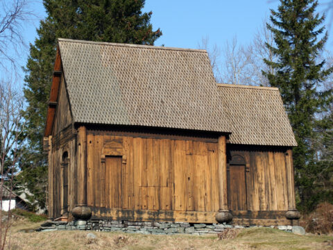
Haltdalen Stave Church was built in the 1170s in the village of Haltdalen, Trøndelag. Two twin churches – or replicas – are built.
View more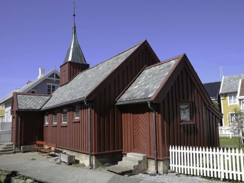
This cute little stave church is located in the village at the small island Grip – a 12 km ferry trip from from Kristiansund.
View more