
Norwegian Scenic Route Hardanger consists of four stretches: Granvin – Steinsdalsfossen (Road 79/49), Norheimsund – Tørvikbygd (Road 49), Jondal – Utne, and Kinsarvik (Road 550) – Låtefoss (Road 13), a total distance of 165 km.
A ferry operates from Tørvikbygd – Jondal and from Kinsarvik – Utne – Kvandal. These roads are open for traffic throughout the year.
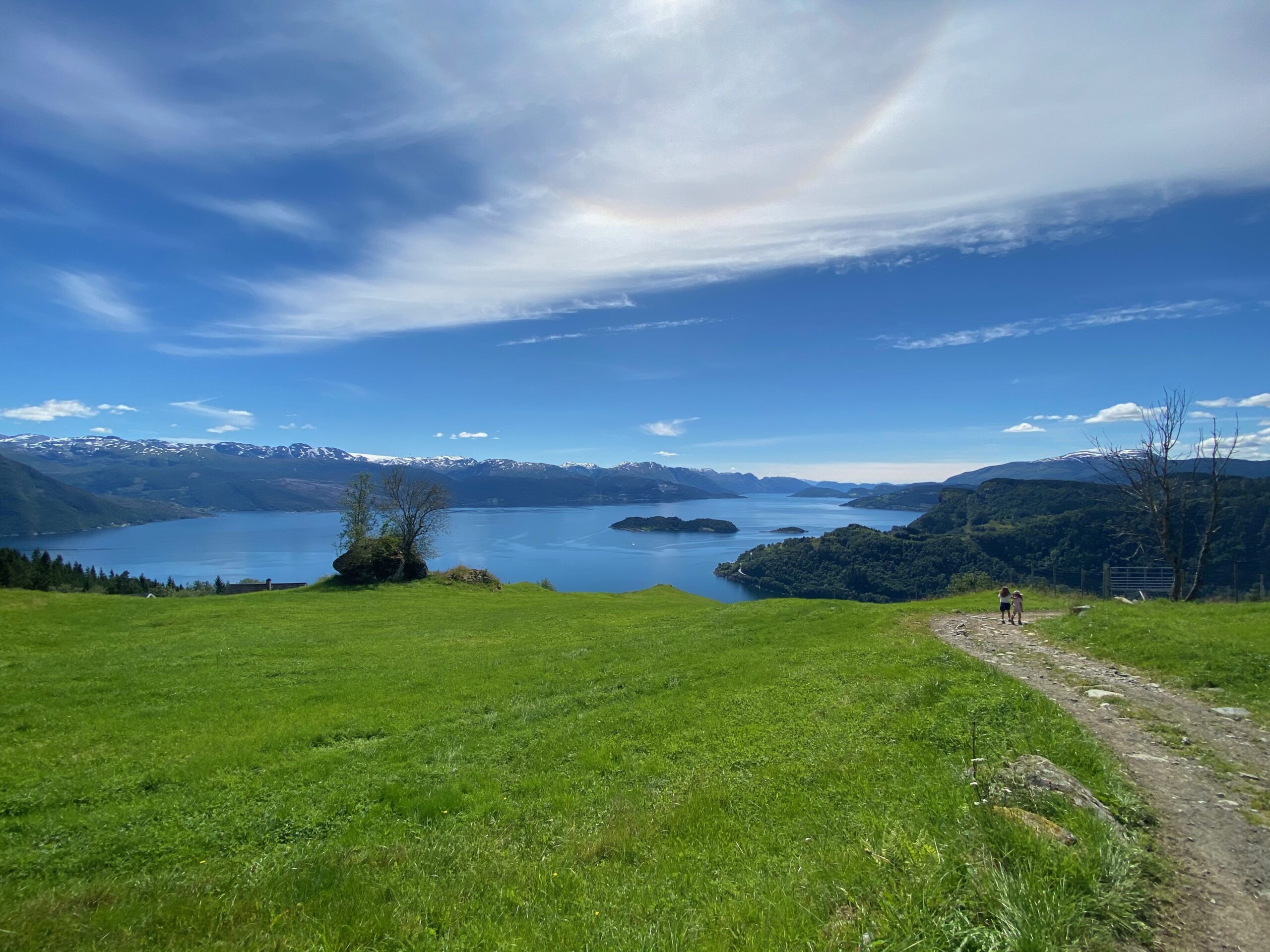
It’s no secret that Hardanger is like a picture postcard, and almost everywhere you look you will feast your eyes on ‘postcard’ waterfalls or fruit trees in bloom. Everything you’ve ever heard about Hardanger is true. Dramatic roads run through dramatic scenery and there is a wealth of variation to absorb.
Here the experience is in the drive. The perfect holiday would be to drive in springtime at the height of the fruit blossoming season, stop to fish in the fjord and then return when fruit picking is underway in late summer.
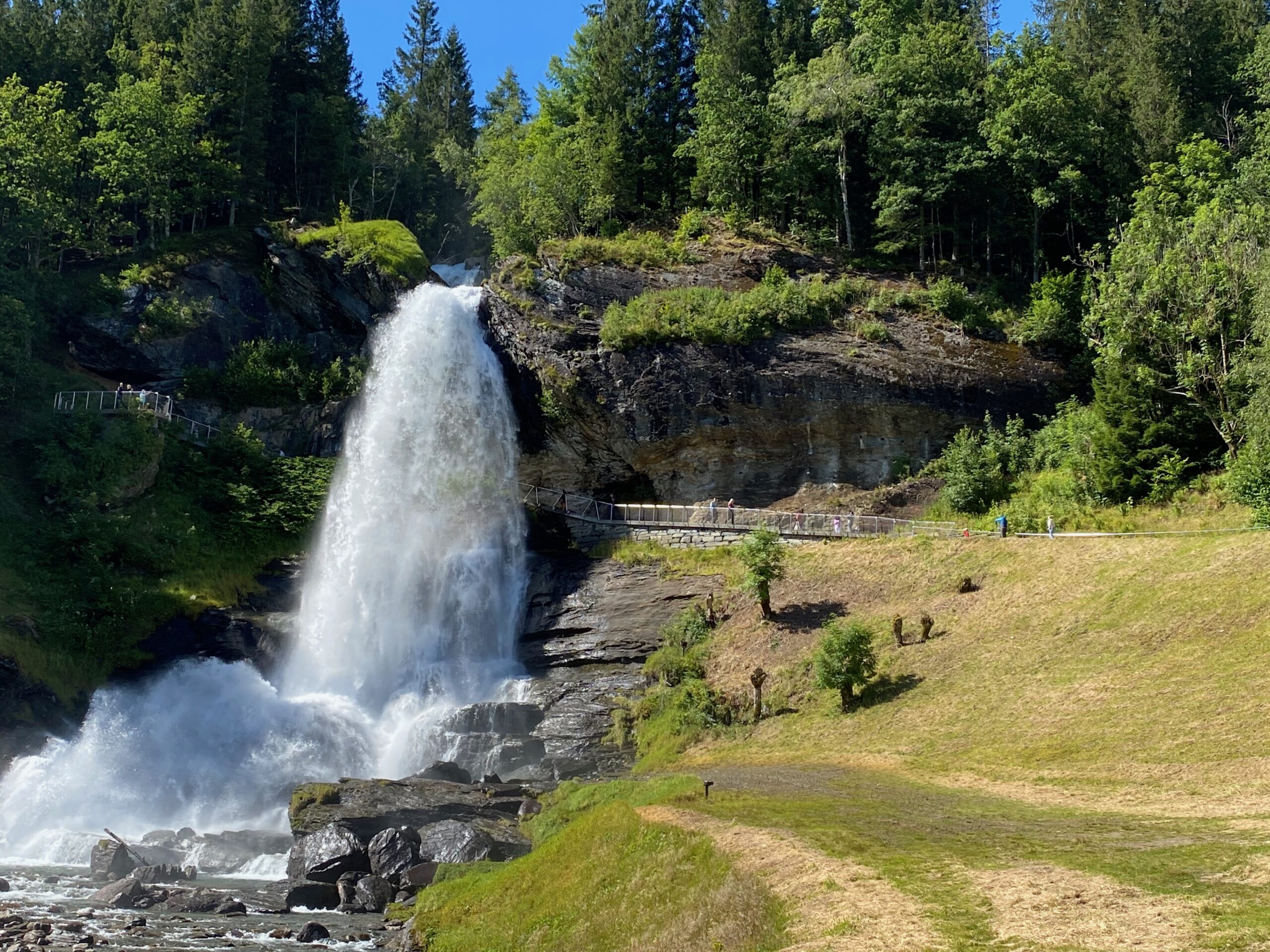
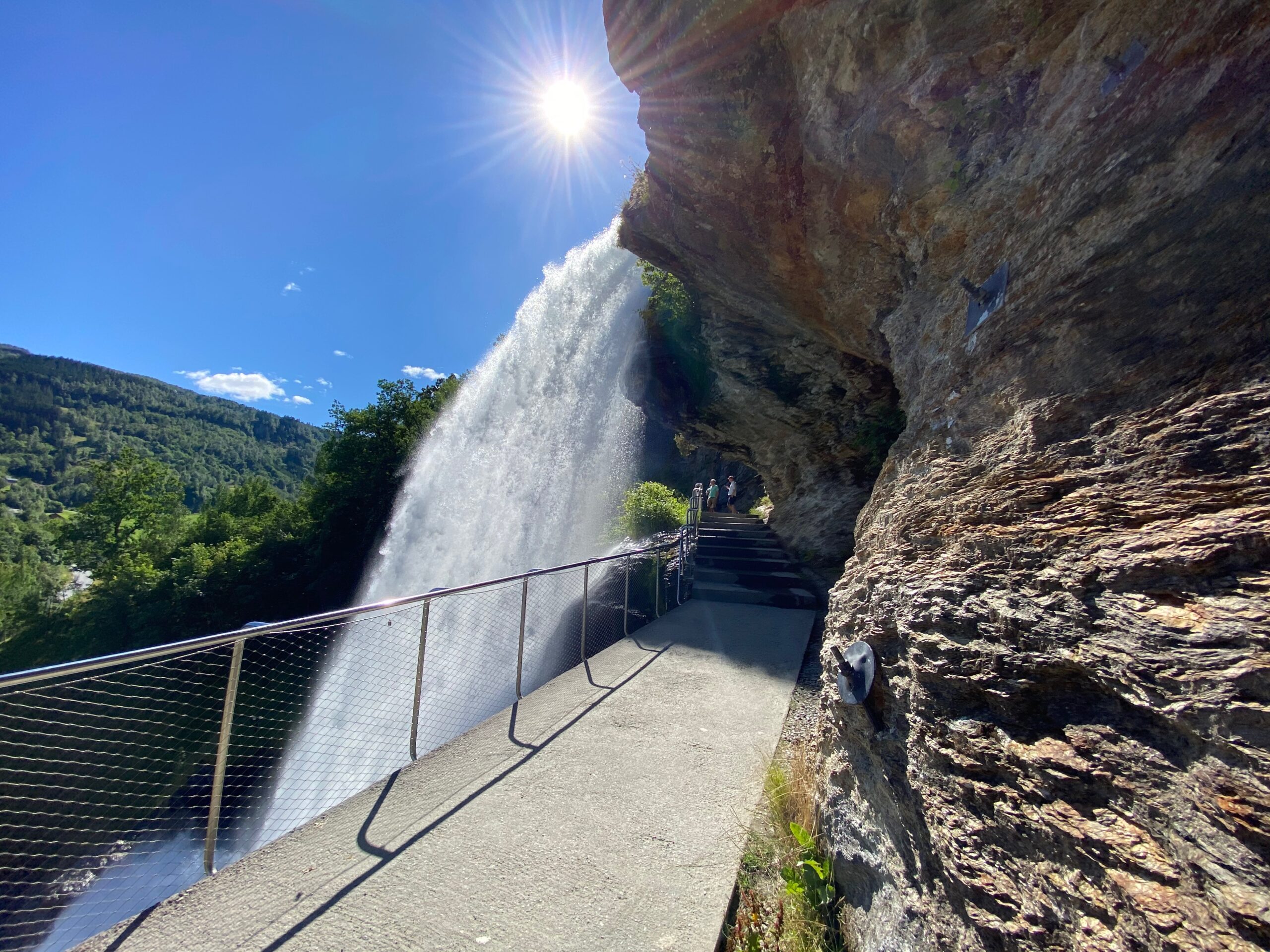
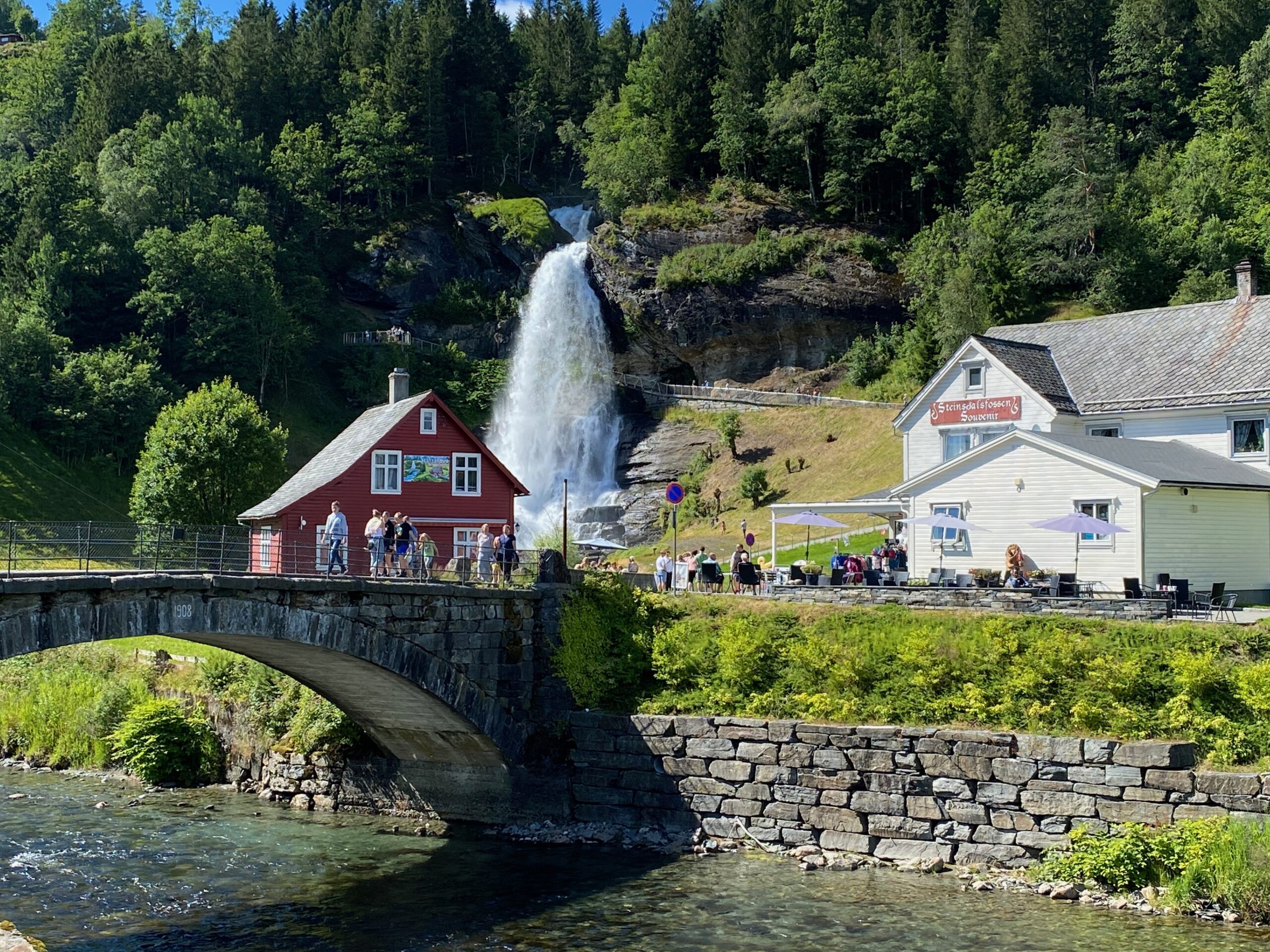
Large waterfalls surrounding Hardanger: Steinsdalsfossen, Vøringsfossen, Skjervefossen, Låtefoss and Furebergfossen. All unique, so check them out.
History
Fruit has been grown in Hardanger since the 14th century, and boat building and the quarrying industry have been vital for the local community. Not all roads in the area have retained their former importance and new and more modern alternatives have been built, but as scenic routes the old roads are as attractive and eminent as at any time. But speaking of newer roads; in 2013, the 1380 meter long Hardanger Bridge opned. It’s not part of the Scenic Route, but hey, if you are in the area anyway…?
Other locations in this part of Norway:
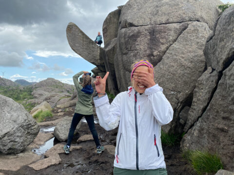
The 'Troll's Dick' (Trollpikken) is a place it's difficult to talk about without giggling – and it is even UNESCO listed…
View more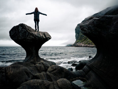
Over thousands of years, ocean waves have ground the rock to the shape Kannesteinen has today. It is located in the village of Oppedal.
View more
Trolltunga is a rock formation about 1,100 meters above sea level in Ullensvang Municipality in Vestland county. PS! NOT a Stop & Go location…
View more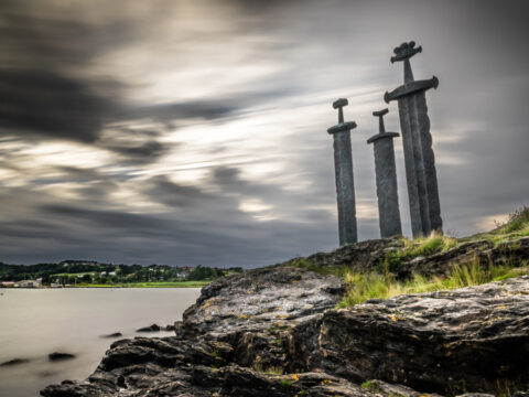
Sverd i fjell (Swords in Rock) is a huge monument located in Hafrsfjord just outside the city of Stavanger.
View more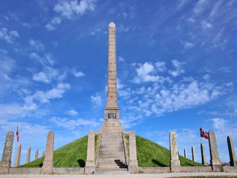
Haraldshaugen is a national monument at Gard, located on King Harald Hairfair's burial mound just outside Haugesund city centre.
View more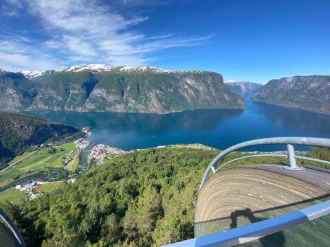
Norwegian Scenic Route Aurlandsfjellet runs from Aurlandsvangen to Lærdalsøyri, a distance of 47 km (Road 5627).
View more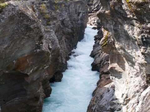
The knight's leap (Ridderspranget) is a gorge in the river Sjoa where a knight, according to the legend, jumped with a girl on his horse.
View more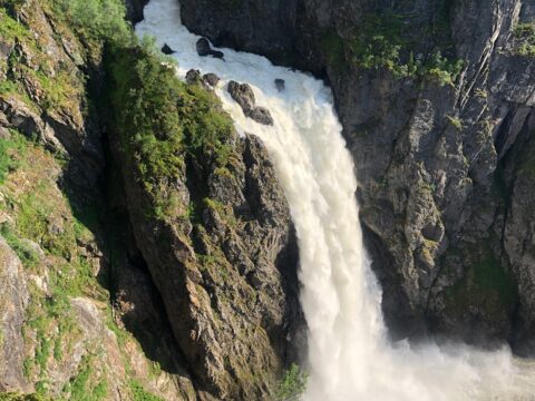
Norwegian Scenic Route Hardangervidda runs from Eidfjord to Haugastøl, a total distance of 67 km (Road 7). This route is open throughout the year.
View more