Photo: Sergio, flickr.com
Norwegian Scenic Route Sognefjellet runs from Lom to Gaupne, a total distance of 108 km (Road 55).
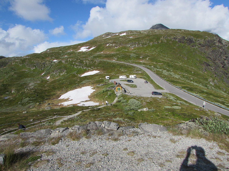
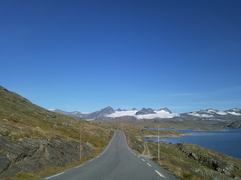
If you start from Lom, the lush cultural landscape of Bøverdalen gives you glimpses of high mountains in the far distance, as the road slowly climbes through the valley. Without too much effort, you climb to 1,434 metres, making the road northern Europe’s highest mountain pass.
At the Mefjellet stop you will find Knut Wold’s stone sculpture which allows you to view the mountain landscape from a different perspective.
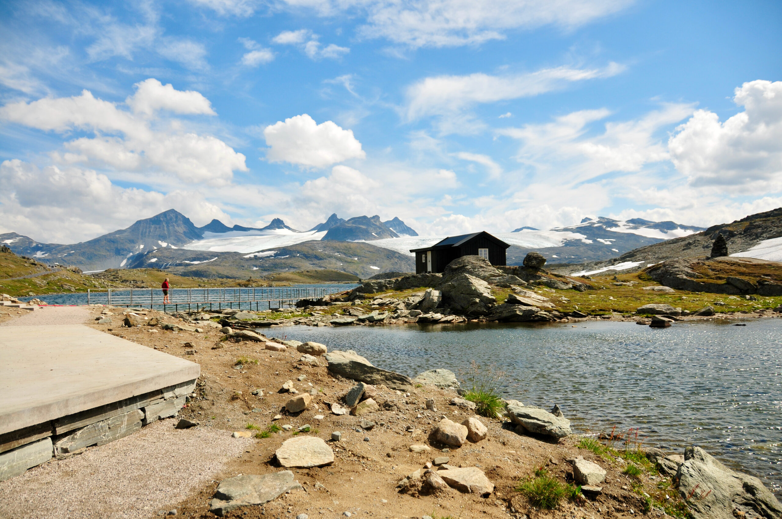
On the other side of the mountain towards Gaupne, the road is steep and somehow more wild. Where the Hurrungane massif towers up to the heavens the mountains suddenly open up and the landscape changes once again. Towards Gaupne, the final point on this stretch, the road descends to skirt the beautiful Sognefjord with clear waters.
Winter notice: The mountain road from Rustasætre/Vegaskjelet to Turtagrø is normally closed in November and reopens in May.
Chech status at the Public Road Administration‘s site.
Check out on this route:
Other locations in this part of Norway:
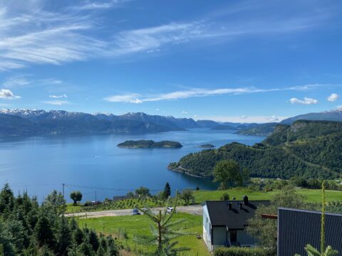
Scenic Route Hardanger consists of 4 stretches and has a total length of 165 km. Try to come spring/early summer when the fruit is blooming.
View more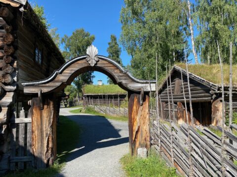
The open-air museum Maihaugen at Lillehammer, is a MUST-DO if in the area. But set aside enough time. It's a huge area to cover, and there is a lot to see.
View more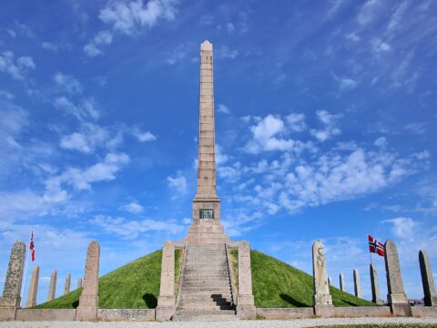
Haraldshaugen is a national monument at Gard, located on King Harald Hairfair's burial mound just outside Haugesund city centre.
View more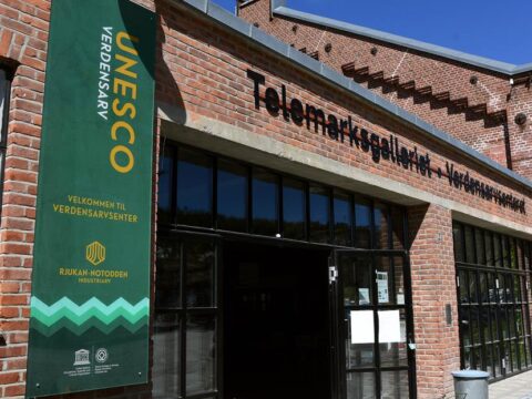
The Rjukan – Notodden Industrial Heritage Site is a UNESCO site created to protect the industrial landscapes in and around the two towns.
View more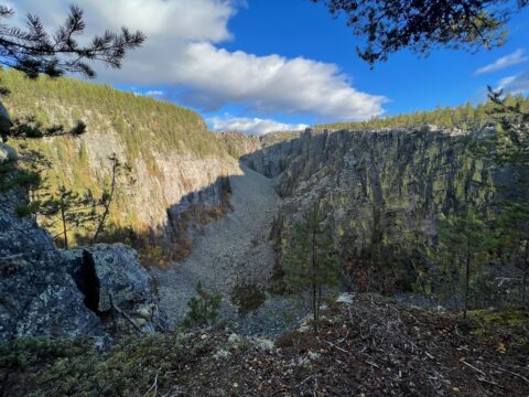
Jutulhogget gorge – 2.4 km long – is the 2nd largest gorge in Northern Europe. It was shaped by the ice more than 10,000 years ago.
View more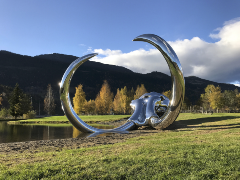
Mammuten (the Mammoth) is a double-sized replica of a mammoth skull located along road E6 in Fåvang, Norway, made by the artist Linda Bakke.
View more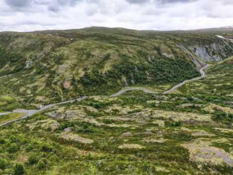
Grimsdalsvegen is an 48 km long gravel, mountain road with an excellent panoramic view of Jotunheimen National Park.
View more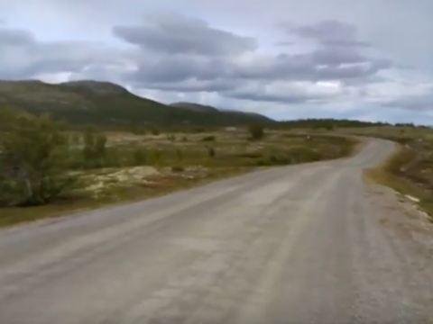
Vinjevegen is an old mountain road stretching from Koppang on road Rv3 near Nordstumoen to Friisvegen in Ringebu.
View more